Snow! Ice! Frigid Cold! A Lovely Week in the Berkshires | 02:18AM / Tuesday, November 12, 2019 | |
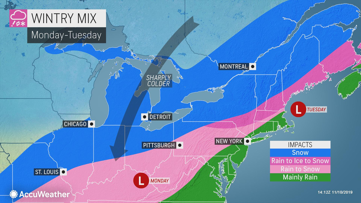
The Berkshires could be in for a messy commute on Tuesday as a winter storm moves into the region from the Midwest.
The National Weather Service is forecasting light accumulations of snow or sleet early on Tuesday morning and as temperatures, it could lead to icy and hazardous conditions.
"Unseasonably and potentially record cold temperatures are expected Tuesday through Thursday," according to the NWS. "High temperatures are expected to remain near or below freezing with overnight lows in the single digits or teens."
The region could get up to 3 inches of snow, and up to 6 inches in the higher elevations, if the storm continues on its Monday track. Accuweather says more than 400 flights had already been canceled by Monday morning in the Chicago area and heavy snow was making its way across western New York State.
Accuweather has the Berkshires down for a mixture of rain and snow, with ice being thrown into the recipe for the far northwest corner and in Southern Vermont. However, the greater amount of frozen precipitation will come later on Tuesday, with 3 to 6 inches possible over North County and less to the south.
Coming in behind the storm is much colder air from our lovely neighbors in the north and Tuesday and Wednesday could be in the single digits! And winter is still nearly six weeks away!
| 
 MEMBER SIGN IN