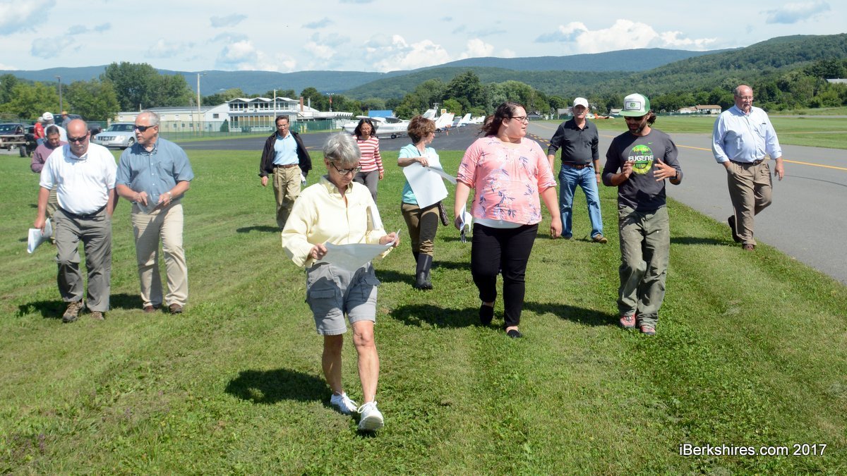
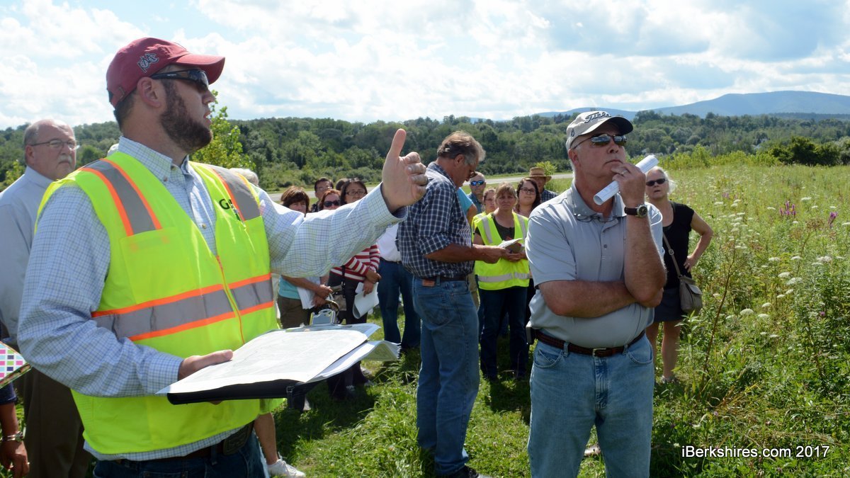
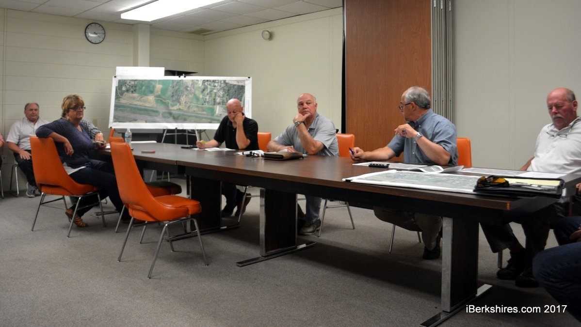
Airport commissioners, city officials, engineers and representatives from the Berkshire Regional Planning Commission review the proposed path for the bike trail through airport land.
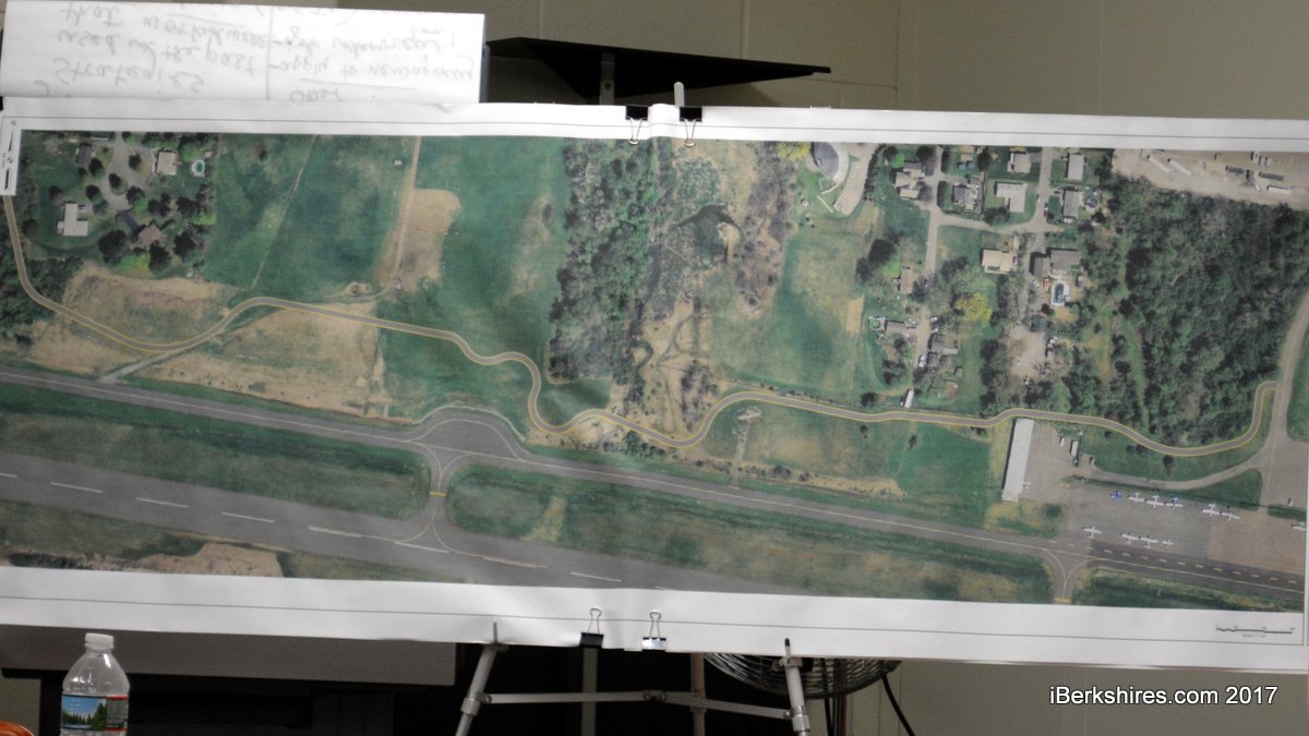
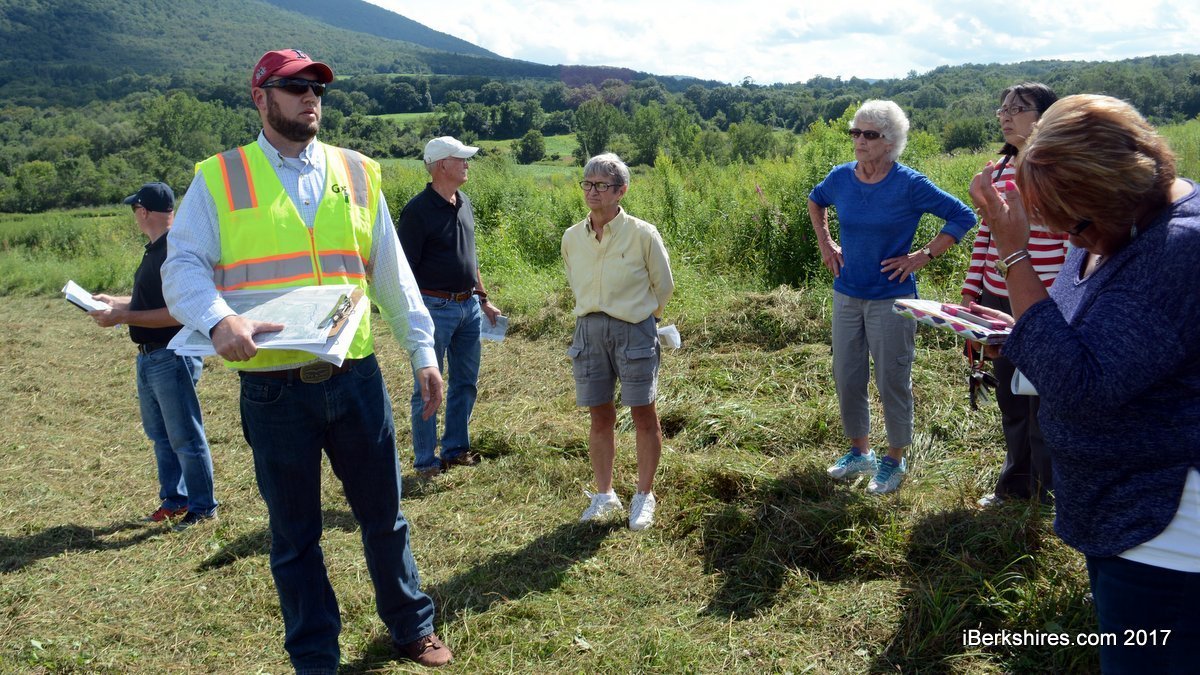
The bike path loops around obstacles as it parallels the runway. The white structure to the right is the Shamrock Hangar. To make the image larger, right click and select 'open in new tab.'
Chairman Jeff Naughton says the tour is solely for the commissioners and they would take questions from the public at a meeting afterward.
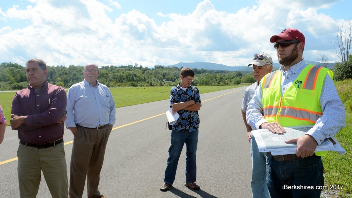
The path must be at least 44.5 feet away from the center line of the taxi lane.
Project engineer Matt Kearney said the path will follow a current right of way up into the fields surrounding the airport.
Residents with properties abutting the airport attended the meeting.
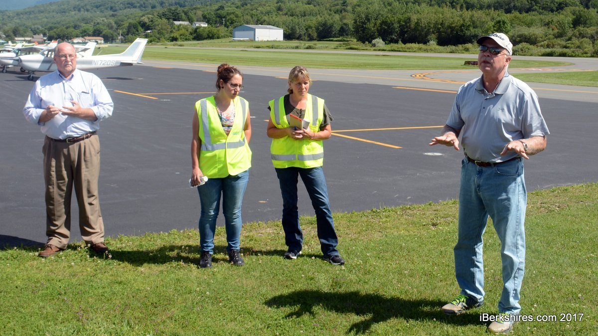
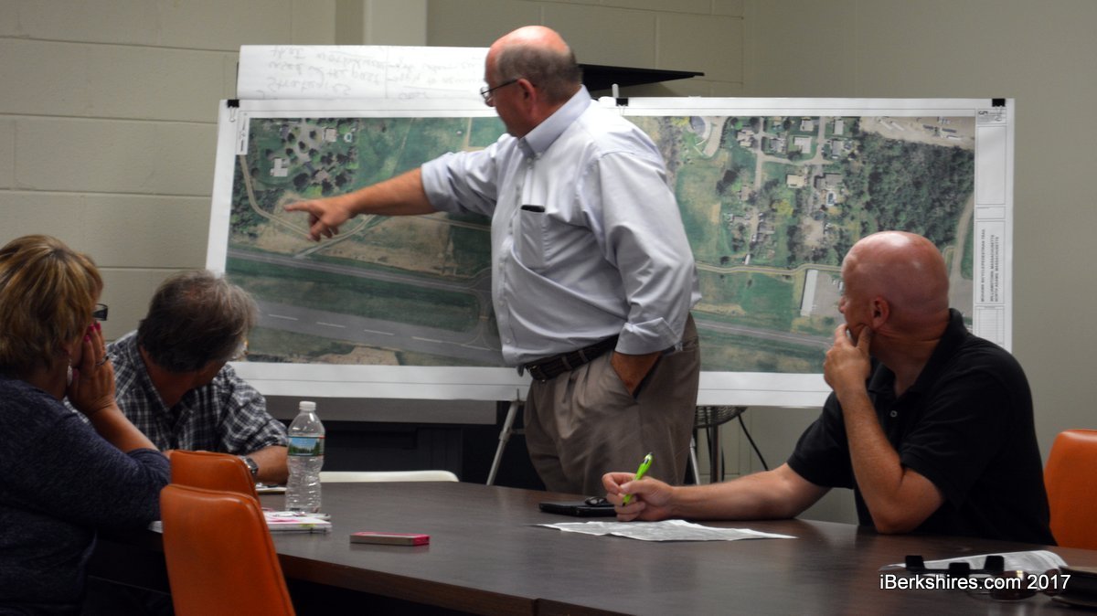
Mayor Richard Alcombright explains how the path will enter the airport.
The Airport Commission approved the pathway pending further input from the FAA and MassDOT to ensure it doesn't interfere with airport operations.
NORTH ADAMS, Mass. — The Airport Commission unanimously voted to approve the general route of the Mohawk Bike Path that will pass through the airport land.
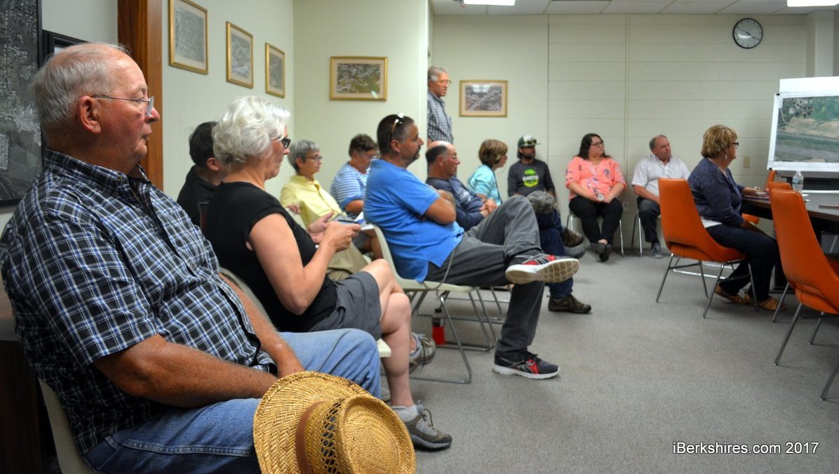
After walking the proposed pathway Tuesday afternoon, the commission reconvened at City Hall to officially give the project its blessing.
"Personally, I am a huge fan of having the bike trail at the airport assuming, it does not affect the airport because I think it will bring activity here," Commissioner Trevor Gilman said.
The proposed path would enter the airport from the west along a modified path adjacent to Chenaille Terrace. It would then move up a hill, which will be graded to meet Americans with Disability Act standards, and align with a right of way connecting one of the abuttor's property to the airport.
"From the last meeting, we discussed bringing the path as close as we can to the taxiway here," project engineer Matt Kearney said. "The idea is to stay as far away from the nearby houses as possible while making the grade to get to the top of the hill."
The path had been initially much closer to a home at the end of the Chenaille Terrace cul-de-sac and the owner had expressed concerns over privacy and safety because of its proximity to the rear of her house.
Kearney and Councilor Joshua Moran, who has been working to develop this section in North Adams, thought it could be pushed farther to the south toward the runway and beyond a berm that would provide more privacy.
The path will plateau as it runs toward the center of the taxi lane then move back down toward the taxiway. The path will move around the weather station closer to the airport property line before heading toward its terminus at the Shamrock Hangar.
The path will ultimately join with Airport Road. The hope is that the one-mile path in North Adams can tap into soon-to-expire scenic byway money to link to the $5 million, 2.5-mile Williamstown bike path project that will end around Galvin Road. The ultimate goal is a single bike path from Williamstown to Pittsfield.
Peter Enzien, representing the airport's engineering firm Stantec, said the trail far exceeds all setbacks needed for the runway but that it must be at a minimum 44.5 feet away from the taxiway center line. This area is known as the "no object" zone.
He said path would also have to work around a three-dimensional transitional zone by Federal Aviation Administration regulations.
"We just have to make sure the path, the fence, plantings and anything along the path are below a certain point," he said.
Enzien said the path within the airport would need to be enclosed in an at least 8-foot high fence that may include barbed wire depending on what the FAA mandates.
The commission had a few concerns and Gilman asked that the path stay away if possible from any possible expansion zones.
"We have very little expansion room at this airport so that’s what it is all about for me among other things," he said.
Gilman also asked that instead of using abuttor David Chenail's easement that connects to the airport, to move the path alongside it.
Chairman Jeff Naughton asked that the path be pulled farther away from the taxiway if at all possible where it is closest.
Kearney said the path can be tweaked as long as it falls within FAA regulations.
"I'm sure there is room to move and I can tighten it up a little farther away," he said.
Gilman said he also felt if the trail moves around the hangar instead of through it, even with needed easements, it may be a little tight.
"If we don't end up going through it but we go around it, I don't know if there is enough room on the property," he said. "I don't think it would allow access to the hangar and it would not be usable by the path users."
Abuttors also shared their concerns and asked why the project was suddenly being fast tracked without further deliberation. The first studies had been done 2000 but serious route planning did not begin until around 2010, when a second feasibility was done, and later from results from surveys for the city's Vision 2020 master plan.
At last month's meeting, the Airport Commission said it hadn't had any communications about the proposed bike trail through the airport since a presentation in 2014.
Only since that last meeting unearthed discussions on the bike path was attention probably brought back to it, Gilman said.
"I think this is coming about because of the iBerkshires article and the people affiliated with the bike path and the city felt they weren't OK to go ahead," he said. "They were concerned that they maybe did not have our approval and this gave them an opportunity to flush this out and point out possible issues."
It was also asked if the commission had the right to move the path farther away from the taxiway and closer to properties, specifically near Chenaille Terrace.
Gilman said the commissioners had the right to move the path around within its border to meet state Department of Transportation and FAA requirements, and their own concerns.
He didn't see that specific area being an issue but said the Airport Commission will continue to work its neighbors.
"We have worked very hard for the 20 years I have been on the commission to work with the neighbors," he said. "Which is why we have a great relationship with the neighbors ... we have moved entire projects around to make our neighbors happy."
Mayor Richard Alcombright said he could have issues if the commission moved that portion of the path.
"The Airport Commission and I have worked wonderfully together for eight years and if they want to move this back toward the houses, that would probably come to an end," he said. "We would lock horns but I think this is doable."
Naughton added that the vote only shows that the commission supports the project and that the path will still be tweaked and come before the commission again.
"This is a process going forward and nothing is etched in stone," he said. "This will be back before us again once we get final details on FAA and MassDOT regulations."
There were also concerns about pathgoers trespassing on to airport abuttors' property.
Alcombright said if it is happening now, the property owners should inform the police but once the trail is complete and marked, it should not be an issue.
It was also asked if the fence surrounding the trail would be a danger to animals.
Kearney said the fence will only be used where needed and they can explore using gate sections through which animals can pass.
northadams.com welcomes critical, respectful dialogue. Name-calling, personal attacks, libel, slander or foul language is not allowed. All comments are reviewed before posting and will be deleted or edited as necessary.

 MEMBER SIGN IN