North Adams Looks at Shorter Bike Trail ProjectBy Tammy Daniels, iBerkshires Staff
03:59AM / Tuesday, February 21, 2017 | |
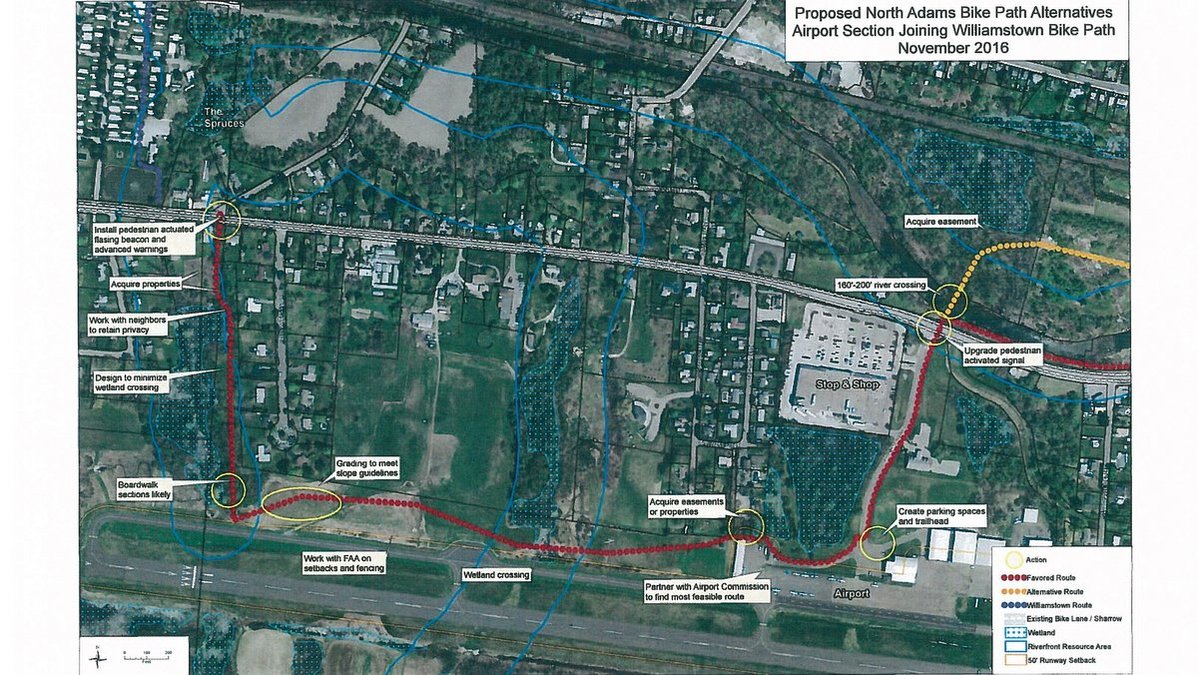 A preliminary route to bring the bike path being built in Williamstown into North Adams. A preliminary route to bring the bike path being built in Williamstown into North Adams. |
NORTH ADAMS, Mass. — The city is still hoping to hook up to the planned bike path that will run through Williamstown, albeit in a truncated fashion.
"What we're kind of doing here is replacing the whole idea of designing a portion of the bike path from the Spruces to MoCA," Mayor Richard Alcombright told the City Council last week. "That kind of fell by the wayside over the last year."
North Adams had been working with the Berkshire Regional Planning Commission to develop a trail that would run from the Williamstown line through Massachusetts Museum of Contemporary Art to Western Gateway Heritage State Park. The trail was part of a much larger vision of connecting the Berkshires between Connecticut and Vermont, with the Ashuwillticook Rail Trail as the guide.
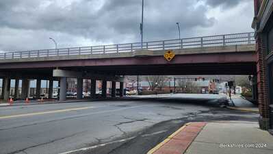
However, the Mohawk Bike Trail ran into serious opposition two years ago when residents in the West End objected to the trail coming through their thickly settled neighborhood. They raised concerns over the trail running through a so-called "pinch point" along Barbour Street between Phelps and Hawthorne avenues and cited fears over traffic, parking, crime and littering.
That sent the BRPC back to the drawing board but the difficulties in terrain, private property, roads and railroad were too much to overcome at this point.
Instead, a draft plan will bring the trail from somewhere near the Spruces in Williamstown south over Route 2 and end about a mile away at Harriman and West Airport.
"This is a very, very rough draft," said Lauren Gaherty, a planner with the BRPC. "It will be a fine line to get the bike path away from residential properties and give them as much privacy as possible while trying to minimize wetlands impact."
The route is "not cemented" because the engineers begun their reviews yet, she said. The commission will be pulling together a more detailed route that is expected to be presented to abuttors in the coming months.
"This was our starting point. It's so ambiguous when we start talking about where it will go," said Councilor Joshua Moran, who has been involved the projct. "This is slightly different because it will be on property owned by the city ... Input is greatly important but at the same time it's a really good opportunity to have 3 1/2 mile bike trail."
Any construction is still about two years away. The goal is to finish design by fiscal 2018 and begin construction in 2020.
Williamstown's route is fairly set and a much easier one than North Adams. It runs largely on level terrain along the Hoosic River on land owned by the town and Williams College for about 2.5 miles. The money for that is set.
North Adams, however, is in a use it or lose it proposition. Money set aside for the trail — from federal Scenic Byway funds and a patchwork of other programs — is still there but will disappear.
"It kept coming loud and clear from Lauren and from the state that if we didn't do something, we would lose that money and that whole project would go away," said the mayor.
He'd hoped to have the trail "pick up" some of the city's assets as it rolled east - neighborhoods in Greylock and Brayton, the two schools and YMCA, the athletic fields, the airport the mountains and finally Massachusetts of Museum of Contemporary Art. The museum, in fact, included a bike way through Building 6, which is undergoing a $55 million reconstruction.
The terminus of the truncated bike path will be at the parking lot at the airport that could be redefined exclusively for the trail. The rest of the trail could cross some private land that would require easements but would largely be on city owned property. There is an issue of slope and wetlands that would have to be addressed as well as moving the trail away from residences along the route, said Gaherty.
"You would have almost three miles of an off-road accessible multiple-use path all the way from Route 7 in Williamstown," she said. "It's trying to ride on Williamstown's success and make a success here in North Adams."
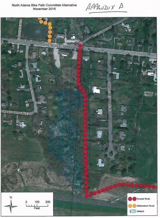
A couple neighbors questioned why routes on the north side of Route 2 weren't considered. Gaherty responded that they were and had the same issues that had complicated the longer version of the trail: wetlands, slope, railroad proximity and residential structures.
"The terrain in North Adams is very difficult," Gaherty said. "This is doable, let's bite off a small chunk ... this is a chance to move forward in real time."
North Adams Bike Path by iBerkshires.com on Scribd
|

 MEMBER SIGN IN